
Elevation Survey for New Driveway Drainage Connections
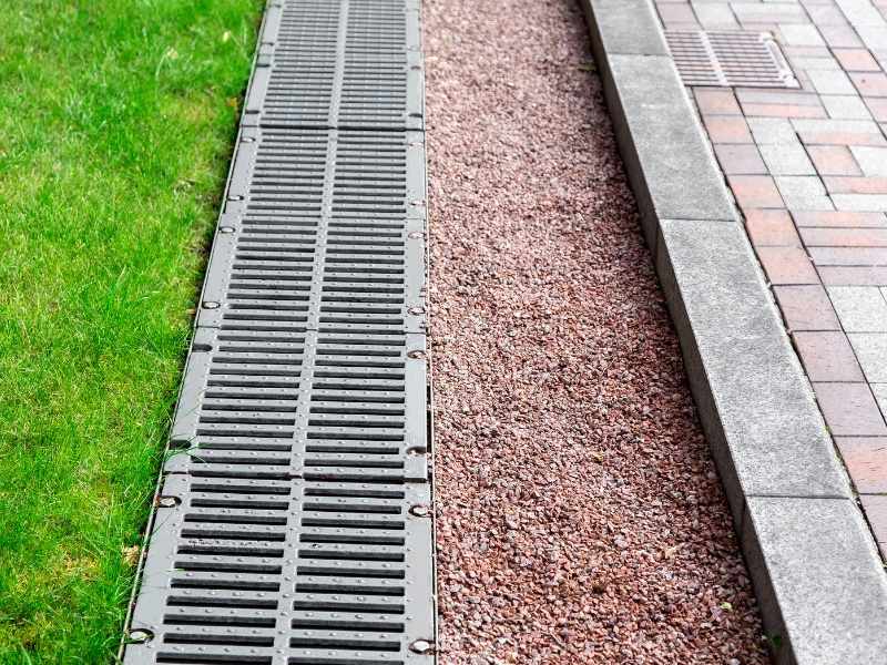
An elevation survey before design is the simplest way to make sure your driveway drains to the right place and connects cleanly to the system around it. Water doesn’t care what the driveway plan says. It follows the ground, and a few inches of grade in the wrong spot can send runoff into a garage, across a neighbor’s yard, or into a street where it ponds every afternoon storm. New concrete makes that problem permanent.
An elevation survey before design is the simplest way to make sure your driveway drains to the right place and connects cleanly to the system around it. Water doesn’t care what the driveway plan says. It follows the ground, and a few inches of grade in the wrong spot can send runoff into a garage, across a neighbor’s yard, or into a street where it ponds every afternoon storm. New concrete makes that problem permanent.
This article is written for property owners planning a new or rebuilt driveway, along with the contractors and designers who build them. The same ideas apply to small commercial entrances. Drainage connections are where most driveway projects get complicated, especially when there’s a roadside swale, a culvert pipe, or a storm inlet nearby. Getting accurate elevations first gives everyone a fixed set of numbers to design and build from.
Reviewing Existing Driveway Elevations and Surrounding Ground Levels
An elevation survey measures the height of points on the ground relative to a fixed reference called a benchmark. For a driveway, the surveyor records heights along the existing pavement, the garage or carport slab, nearby yard areas, and the edge of the road. Those points show how the site slopes today. They also reveal low spots where water already collects.
The garage floor is one of the most important numbers. If the finished driveway ends up too close to that height, water can run straight toward the door. The surveyor also measures ground near the house foundation, walkways, and the property line. Neighboring grades matter because runoff that leaves your lot has to go somewhere, and it shouldn’t be onto the house next door.
Identifying Drainage Connection Points and Required Slopes
Every driveway needs a place for water to go. Common outlets include a roadside swale, a culvert pipe under the driveway, a curb and gutter, a storm inlet, or an on-site drainage area. The surveyor locates these features and measures their key elevations. For pipes and structures, that usually means the rim, which is the top of the grate or lid, and the invert, which is the inside bottom of the pipe.
Those numbers decide whether water can actually reach the outlet. A culvert set too high will back up. A swale that’s been filled in over the years may no longer carry water at all. Slopes for driveways, pipes, and swales come from your designer and the applicable local standards, and they can vary by municipality, county, and road owner. The survey gives the designer the real field elevations to check those slopes against.
How an Elevation Survey Supports Driveway Grading Plans
A grading plan shows the finished heights the driveway should be built to. It’s only as good as the survey behind it. With accurate elevations, the designer can set the driveway’s high and low points, plan cross slopes, and decide where a trench drain or other feature might help. Without them, the contractor ends up guessing in the field.
Here’s what a useful survey for driveway grading often includes:
- Spot elevations along the existing driveway and garage slab
- Ground heights at the house foundation and nearby walkways
- Edge of road, curb, or swale elevations at the entrance
- Rim and invert elevations of nearby culverts and inlets
- Property lines and any recorded drainage easements
Ask your surveyor and designer to agree on the benchmark and vertical datum before work begins. A datum is the reference system the heights are based on. If the design and the field layout use different datums, the driveway can be built inches off without anyone noticing until it rains.
Coordinating Driveway Runoff With Existing Stormwater Infrastructure
Many driveways connect to systems owned by someone else. The roadside swale, the culvert, and the curb inlet may belong to the city, county, state, or a homeowners association. Those owners often have their own rules for pipe size, material, and placement within the right-of-way. A right-of-way is the strip of land set aside for the road and its utilities, and it usually extends past the edge of pavement.
Permits for driveway connections are common, but requirements differ by road owner and location. Check with the agency or association before design is final. Some reviewers ask for survey data or a plan showing proposed elevations. Your surveyor can show where the right-of-way line falls, which helps everyone understand where private work ends and public work begins.
Drainage easements deserve the same attention. Paving over a recorded easement or blocking a drainage path can create problems with the easement holder. The survey shows recorded easements that can be located from the title documents.
Verifying Finished Driveway Elevations Before Construction Completion
Checking elevations before the final pour saves expensive fixes. Once the forms are set or the base is graded, the surveyor can measure key points and compare them to the plan. That includes the driveway at the garage, the low points, and the connection to the swale or pipe. Small corrections are easy at this stage.
After the work is done, an as-built check confirms what was actually built. Some reviewers or HOAs ask for this before signing off, while others don’t. The record is also useful if a drainage complaint comes up later. It shows that the driveway and culvert were built to the approved grades, which protects both the owner and the contractor.
Frequently Asked Questions
What is an elevation survey for a driveway?
An elevation survey measures ground heights across the driveway area and nearby features. It records the garage slab, yard grades, road edge, and drainage structures. Designers use the data to plan slopes that carry water away from the house. Contractors use it to build the driveway to those slopes.
Is an elevation survey the same as an elevation certificate?
No, they serve different purposes. An elevation certificate is a FEMA form used for flood insurance and floodplain compliance on a building. An elevation survey for a driveway collects site grades for design and construction. Your surveyor can prepare either one depending on your needs.
Do I need a permit to connect my driveway to a swale or culvert?
Many road owners require a permit for work in the right-of-way, including culverts and swale changes. Requirements vary by city, county, state, and association. Some reviewers ask for survey data with the application. Check with the road owner early so the permit doesn’t delay construction.
