
How a Topographic Survey Supports Park and Trail Expansion
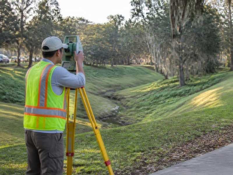
A growing community wants more places to walk, bike, and gather. Parks add trails, connect green spaces, and stretch into new ground. That kind of expansion looks simple until the terrain gets in the way, which is where accurate survey mapping becomes important.
Land that seems flat and open is rarely either. Hidden slopes, wet low spots, and old features can throw off a trail plan fast. Build without accurate ground data, and a path may flood, wash out, or climb too steeply for comfort. Those problems cost far more to fix after construction than before.
A topographic survey maps the real shape of the land before a park or trail expands. That information supports surface modeling that guides trail routes, grading, and drainage for the whole project. The sections below explain what the survey captures and why it matters for park and trail work.
Mapping Existing Terrain Before Park Expansion Begins
A topographic survey records the shape of the land and the features on it. It shows elevations, slopes, and the position of things like trees, water, and existing paths. For a park expansion, it captures the ground exactly as it stands today and provides reliable information for corridor planning as new trails and connections are laid out.
That record is where good planning starts. A design team needs to know the real terrain before they route a single trail. They also need to see wetlands, tree stands, and other features that shape what is possible. A topographic survey puts all of it on one accurate map.
Expansion areas are often rough and undeveloped. The new ground may include woods, slopes, or low wet areas. In the Jacksonville area, flat terrain and a high water table make small elevation changes matter. The survey reveals those subtle shifts that a rough map would miss.
Using Elevation Data to Plan Trail Alignments
A trail alignment is the route a path takes across the land. Good alignments follow the terrain instead of fighting it. Elevation data from a topographic survey makes that possible.
The survey shows slopes and grades across the whole site. Designers use it to route trails at comfortable, accessible slopes. A path that climbs too steeply is hard to use and quick to erode. Elevation data helps the team find gentler routes that work for more people.
The data guides other alignment choices too:
- Keeping trails at usable, accessible grades
- Routing around steep or unstable slopes
- Avoiding wet or flood-prone low spots
- Working with natural features instead of cutting through them
- Planning where a trail may need a boardwalk or bridge
Planning alignments this way saves money and effort. A route that fits the land needs less grading and holds up longer.
Identifying Drainage and Site Constraints Along Proposed Routes
Drainage is a major concern for any trail. Water that collects on a path erodes it and makes it unusable. A topographic survey shows how water moves across the ground.
The elevation data reveals low spots, slopes, and existing drainage paths. Designers use it to route trails away from standing water and to plan crossings where needed. On flat Florida sites, where water drains slowly, this matters even more. A trail through a wet low spot will fail without a plan for the water.
The survey flags other constraints too. It can show wetlands, steep banks, and features that limit where a trail can go. Wetlands and protected areas often carry rules that affect the design. Those requirements can vary by county, city, and project scope, so confirm what applies to your site early.
Coordinating Survey Data With Park Design Plans
A topographic survey does its best work when the whole team shares it. The data turns into detailed terrain models and base maps. Designers, engineers, and planners all build from the same accurate ground.
A shared base keeps everyone aligned. When the survey, design, and engineering teams use one set of elevations, the plans fit together. That reduces conflicts, rework, and surprises once construction starts. It also helps with reviews, since officials can see how the plan handles grade and drainage.
The survey supports the full scope of a park expansion. Beyond trails, it guides where to place restrooms, parking, shelters, and play areas. Each of these depends on the grades around it. Accurate terrain data ties the whole design together.
Reducing Construction Risk With Accurate Topographic Data
Most construction problems trace back to something unknown at the start. A hidden slope, a wet area, or a drainage path no one mapped. A topographic survey brings those unknowns into the open before work begins.
That early clarity protects the project in plain ways. It keeps trails at grades that will not erode or flood. It helps the team estimate earthwork and materials more accurately. It lowers the chance of costly changes once crews are on site.
Treat the survey as an early step, not an afterthought. Order it before the design and trail routes are set. If a permit or construction schedule depends on it, book the survey early. Accurate terrain data at the start keeps a park and trail expansion on track.
