
Land Surveying for Properties Near New Transportation Projects
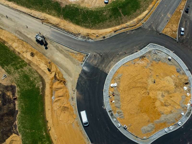
A new road, rail line, or transit corridor can change the ground around a site in a matter of months. Access points move. Water starts flowing in new ways. Land surveying gives developers a clear record of a property before that work begins, and it shows how a nearby project might reach onto the land. Order the survey early, and you protect your boundaries, your value, and your build schedule.
How New Transportation Projects Can Affect Nearby Properties
Big transportation work rarely stays inside its own limits. A widened highway may pull in extra right-of-way along the edge. A new interchange can cut off an old driveway or reroute traffic past a site. These changes touch access, grading, and the way rain drains across the area.
Access is the change owners feel first. A project can close a curb cut, add a median, or turn a two-way street into one-way traffic. If your only entrance sits on the affected road, your whole site plan may need a rethink. A survey of current access points gives you a starting line for that talk with the agency.
Drainage is often the quiet problem. When crews raise a road or add a new curb, water can pond in places it never did before. A property that stayed dry for years might start holding runoff after the project opens. Knowing your current grades and drainage paths helps you catch these shifts fast.
Why Land Surveying Matters Before Construction Begins
The best time to survey is before the first machine shows up. A current survey confirms where your lines really sit, not where a fence or old deed suggests. It also records the improvements already on the ground, like buildings, pavement, and utilities. That baseline becomes your proof if a dispute comes up later. For commercial site development, having accurate property information early helps teams understand how nearby transportation changes may affect access, easements, and future construction plans.
An early survey also sets you up to read the project’s own plans. Agencies publish right-of-way maps and design drawings as work moves forward. When you lay those against your own survey, the overlap jumps out. You see what they claim, what you hold, and where the two disagree.
Checking Right-of-Way and Easement Impacts
Transportation projects often need land. Agencies may buy a strip along the front of a parcel, or take a temporary work area during construction. A survey shows exactly how much of your land falls inside a proposed right-of-way. That detail matters when you review offers, plan setbacks, or push back on a taking.
Timing on these takings can be slow and confusing. A parcel might sit under a proposed right-of-way for months before anything is final. During that wait, a survey helps you track what is proposed against what is recorded. That record protects you if the plan shifts again.
Utility relocations bring their own surprises. Power, water, and fiber lines often move to make room for a new road or rail line. Those moves can add fresh easements across a site, or change access to an existing one. A survey maps where these rights land, so you can plan around them instead of reacting late.
Documenting Existing Property Conditions Near the Project
Heavy construction next door can crack pavement, shift soil, and damage nearby features. A condition survey creates a dated record of the site before any of that happens. If damage shows up later, that record helps you show what changed and when. It gives you a fair footing in any claim.
A good condition record usually captures items like these:
- Fences, walls, and retaining structures
- Driveways, parking areas, and sidewalks
- Buildings, foundations, and outbuildings
- Drainage ditches, inlets, and culverts
- Trees, poles, and other fixed features
Developers carry extra reasons to document early. Lenders and insurers may ask for proof of pre-construction conditions on a nearby parcel. A clear record can also lower your risk if a neighbor blames your future work for damage that a road project caused. Spend a little now, and you skip a messy fight later.
Photos help, but measured survey data carries more weight. It ties each feature to a real location and elevation. Pair the two, and you have a strong before picture to compare against later.
When Property Owners May Need Updated Survey Information
An old survey can miss a lot near an active project. If you plan to sell, a buyer or lender will often want current information. A land survey before development can provide updated details about access, boundaries, easements, and existing conditions before new transportation work changes the surrounding area. It also helps keep a deal or future project from stalling at the closing table.
Other moments call for an update too. You might plan a new building, split a parcel, or worry that a boundary marker moved during construction. Access changes near a new road are another common reason. When any of these come up, a new survey turns guesswork into clear facts you can act on.
Timing matters as much as the update itself. A survey done right before a sale or a permit filing carries the most weight. One pulled together in a rush after work starts may miss the clean baseline you wanted. Plan the update around your next big decision, and it works harder for you.
Frequently Asked Questions
Does a nearby transportation project change my property lines?
The project itself does not move your legal property lines. However, a transportation agency may acquire part of a property for right-of-way, which can change the size or configuration of the parcel. A survey can document the existing boundary and help show how any proposed acquisition relates to the property.
How early should I order a survey before construction starts nearby?
It is generally best to obtain a survey early, before nearby construction changes existing site conditions. Early documentation can help establish current boundaries, easements, access points, drainage features, and visible improvements before work begins.
Can a survey help if construction damages my property?
A survey or existing-condition documentation can help establish what was present before construction started. Records of fences, pavement, drainage features, structures, and other improvements may be useful when comparing conditions before and after nearby work.
