
Topographic Survey for Driveway Sight Distance Reviews
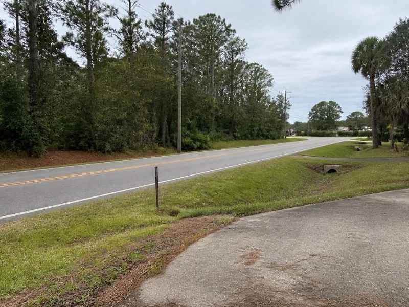
You want a new driveway, but the county wants proof that drivers can see. That proof starts with a topographic survey. Poor visibility at a driveway is a real safety risk, and it can stop your permit cold. A hidden dip in the road or a slope near the entrance can block a driver’s view. Getting the ground measured first tells you what you are working with before you design or dig.
Sight distance is the length of road a driver can see from a driveway. It gives drivers time to react as they pull in or out. Reviewers check it to keep entrances safe. A topographic survey provides the elevation data behind that check.
How a Topographic Survey Captures the Driveway Approach
A topographic survey is a map of the ground’s shape and features. It records elevations, slopes, and existing objects on a site. For a driveway review, it captures the approach where the driveway meets the road.
The surveyor measures many points across the area. Each point has a height and a location. Together they show how the land rises and falls near the entrance. This turns a rough slope into precise data an engineer can use.
The survey also records existing features near the driveway. That includes the road edge, ditches, utility poles, trees, and signs. These items can affect both the design and the view. Mapping them early avoids surprises later.
In Jacksonville, many roads run flat but carry fast traffic. Even a small rise or a roadside ditch can change what a driver sees. A topographic survey pins down these conditions so the review starts with facts. That protects your project and the people using the road.
Road Grades and Terrain Along the Sight Line
Grade is the slope of the road or land, measured as a rise over a distance. Along a roadway, grade changes constantly. Those changes shape what a driver at your driveway can see in each direction.
A crest is a high point where the road rises then falls. A crest near your driveway can hide oncoming cars. A driver may not see a vehicle until it tops the rise. That shortens the usable sight distance and raises the risk.
Dips work the same way in reverse. A low spot can drop a car out of view for a moment. The topographic survey maps these crests and dips along the road. The data shows exactly where the terrain limits the view.
Here is what the survey helps reveal along the sight line:
- Crests that hide approaching traffic
- Dips that drop vehicles out of sight
- The overall slope of the road past the driveway
- Points where the ground blocks a clear line
With this information, an engineer can measure the true sight distance. They compare it to the standard the reviewer requires. If the terrain falls short, the survey shows why and where. That guides any fix, like regrading or moving the entrance.
Vegetation, Slopes, and Features That May Limit Visibility
Terrain is not the only thing that blocks a view. Physical features near a driveway can cut off sight lines too. A topographic survey documents these so nothing gets missed.
Vegetation is a common culprit. Tall hedges, thick brush, and low tree branches can hide a car. In the Jacksonville climate, plants grow fast and full. What is clear one season may be blocked the next. The survey records where vegetation sits near the entrance.
Slopes and banks also matter. A raised bank along the road can act like a wall to a driver’s eye. A steep side slope near the driveway can force a car to stop in a poor spot. Mapping these helps the design account for them.
Other features can limit visibility as well:
- Fences and walls near the road
- Utility boxes, poles, and signs
- Parked vehicles in a regular spot
- Structures close to the property corner
The survey captures the fixed features clearly. It shows their height and position relative to the driveway. An engineer then judges which ones block the view. Some can be trimmed or moved. Others may require a design change. Either way, you learn this before construction.
Sight Distance in Both Directions of Travel
Visibility must work both ways. A driver leaving your property looks left and right before entering the road. So the review checks sight distance in each direction of travel, not just one.
Picture pulling out of your driveway. You need to see cars coming from the left and cars coming from the right. If either view is short, the entrance is unsafe. A single viewpoint does not tell the whole story.
Each direction can have its own problem. A crest may block the view to the left while the right stays clear. A hedge may hide the right while the left is open. The topographic survey covers enough road in both directions to catch these differences.
The evaluation also considers the driver’s eye position. A driver sits at a set height, and an approaching vehicle has its own height. Sight distance measures whether the driver can see that vehicle over the ground between them. The survey’s elevation data makes this measurement possible.
Checking both directions keeps the review honest. It confirms a driver can enter and exit safely under real conditions. This two-way check is a standard part of a proper sight distance review. The exact distances required can vary by road type, speed, and local rules, so confirm the standard early.
Survey Data for Driveway Design and Engineering Review
A topographic survey does more than flag problems. It gives the design team the base they need to build a safe entrance. The survey data supports both the driveway design and the engineering review.
Engineers use the elevation points to set the driveway’s grade. A driveway that is too steep can scrape cars or drain poorly. The survey helps design a slope that works and meets local standards. It also helps place the entrance where sight distance is best.
The data supports the review submission too. Reviewers want to see measured evidence, not guesses. A topographic survey provides that record in a form they trust. This can speed approval and reduce back-and-forth.
The survey helps the team plan several things at once:
- The driveway location with the clearest view
- A safe and workable driveway grade
- Any regrading needed to improve sight distance
- Removal or trimming of view-blocking features
- Drainage that fits the entrance and the road
Timing helps your project. Order the topographic survey early if your permit or construction depends on it. Survey and review requirements can vary by property type, road, and county, so confirm what applies to your site. Starting with solid ground data keeps the design on track and the entrance safe.
A driveway review can feel like a hurdle, but it protects everyone who uses the road. With accurate elevation data, your team can design an entrance that passes and performs. Our local group knows Jacksonville roads, drainage, and access requirements. Reach out when you are ready to plan your driveway with confidence.
