
LiDAR Mapping for Smarter Stormwater Planning on Large Sites
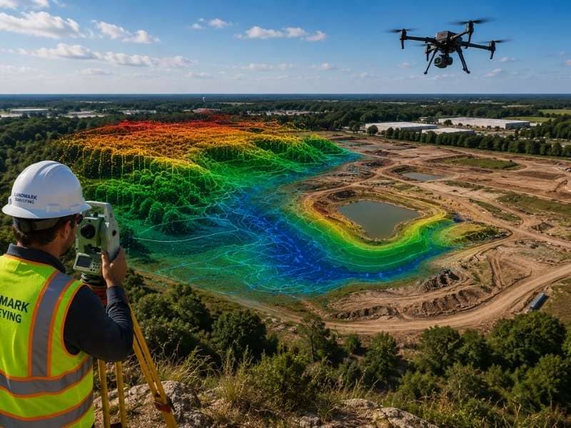
Large properties are hard to study with ground surveys alone. Long distances, thick plants, steep slopes, and hidden drainage paths make early planning harder. LiDAR mapping helps project teams collect detailed elevation data across wide areas. This helps them see how water might move through a site before building starts.
The data can show low areas, slopes, channels, and other features that affect runoff. Engineers use this information to study drainage patterns, plan grading, and spot stormwater problems earlier.
LiDAR does not replace traditional surveying. It adds another layer of detailed terrain data that supports fieldwork, design, and long-term site planning.
Why Accurate Terrain Models Improve Stormwater Planning
Stormwater planning starts with a clear view of the land. Water follows changes in elevation, even when those changes are hard to see. A slight slope may send runoff toward a road, a building, a wet area, or a nearby property.
A detailed terrain model shows how the land rises and falls. Engineers use it to trace likely drainage paths and find areas where water may collect after heavy rain.
Accurate elevation data also helps teams figure out how much grading a site will need. If the land has sharp slopes or wide low areas, the design may need extra drainage features or a different layout.
Spotting these conditions early can reduce design changes later. It also helps the team compare options before construction begins. Changes are easier and cheaper to make at this stage.
Broad terrain coverage matters most on large sites. A drainage issue may start far from the planned building area. That is why the whole property needs review, not just the active construction zone.
How LiDAR Mapping Reveals Surface Features Across Large Properties
LiDAR uses laser pulses to measure the distance between a sensor and the ground. These measurements create a dense set of elevation points called a point cloud.
Special software turns the point cloud into maps and models. These show the shape of the land. Depending on the project, the data may come from aircraft, drones, vehicles, or ground-based equipment.
LiDAR mapping can help reveal features such as:
- Natural and man-made drainage channels
- Ridges, slopes, and low areas
- Berms, ditches, and embankments
- Road edges and large paved surfaces
- Changes in terrain across wooded or open land
These features can affect how fast water moves and where it collects. They show which parts of the property need closer study.
LiDAR also helps teams review large areas faster than ground measurements alone. But trees, buildings, water, and other conditions can affect the results. The survey team must check and process the data carefully before using it for design.
Supporting Drainage Design Before Construction Starts
Early stormwater planning often shapes the rest of a project. Drainage needs can affect road locations, building sites, parking areas, utility routes, and open space.
LiDAR mapping gives engineers a detailed base for this early work. They can use the terrain model to study runoff direction, estimate drainage areas, and find places that may need swales, channels, ponds, pipes, or other stormwater controls.
The data can also support early grading plans. Engineers can compare existing elevations with planned site levels. This helps them estimate where soil needs to be cut or added.
This does not mean the first terrain model is the final design. Engineers still need field data, soil information, survey control, and other records. They also need to check drainage structures, pipes, and other things that surface data alone cannot show.
Still, early LiDAR data helps the team ask better questions. It may reveal a low area that needs more study. It may also show that a planned road crosses a natural drainage path.
Finding these issues before construction leads to better decisions. It also lowers the risk of major changes later.
Combining LiDAR Mapping With Traditional Land Surveys
LiDAR mapping works best when it supports traditional land surveying, not when it replaces it.
A regular survey gives precise field measurements tied to known control points. Surveyors also locate property lines, structures, utilities, and drainage features. A remote dataset may not show these clearly.
LiDAR adds broad coverage and many surface measurements. This makes it useful for building detailed terrain models across large or complex properties.
Together, the two methods give a stronger view of the site. LiDAR may show the overall slope of a large field. A survey crew then confirms key elevations and drainage structures. The field team may also check areas where plants, standing water, or construction affected the LiDAR results.
Ground checks stay important because the data must match real site conditions. Survey control also helps place the LiDAR data in the right position.
Project teams should decide how to combine the two methods before data collection begins. Clear planning helps avoid gaps, repeated work, and confusion about which features need field checks.
Long-Term Benefits of LiDAR Mapping for Site Development
Detailed terrain data stays useful after the first design is done. A well-organized LiDAR dataset can support future work on the property.
For example, owners may use the data when planning an expansion, adding a parking area, or reviewing drainage after a big storm. Maintenance teams may also use it to study ditches, slopes, ponds, and other large site features.
If the property changes over time, teams can compare new LiDAR data with older data. This can help show erosion, settling, soil movement, or changes in drainage paths.
Detailed terrain records can support:
- Future site expansion
- Stormwater system improvements
- Maintenance planning
- Land management decisions
- Review of surface changes over time
The data works best when it is stored clearly and tied to reliable survey control. Owners should also keep records of the date, source, accuracy, and limits of the dataset.
LiDAR is not a complete answer to every site question. But it gives a strong base for future studies. It also cuts down the need to rebuild the whole terrain model for each new project.
Frequently Asked Questions
What is LiDAR mapping used for in land development?
LiDAR mapping creates detailed terrain models. These help project teams study slopes, drainage paths, low areas, grading needs, and other surface conditions on a site.
Can LiDAR mapping identify drainage problems?
It can help reveal features linked to drainage problems, such as low areas, channels, steep slopes, and blocked flow paths. Engineers must still check the data and confirm key conditions in the field.
Is LiDAR mapping accurate enough for engineering projects?
It can give useful engineering data when trained professionals collect, process, and check it correctly. The accuracy needed depends on the project, equipment, site conditions, and design needs.
Does LiDAR mapping replace a traditional land survey?
No. It adds detailed surface data, but field surveying is still important. Surveys confirm control points, property lines, utilities, drainage structures, and other features that need direct checks.
When should LiDAR mapping be performed during project planning?
It works best early in the planning process. Early collection gives engineers time to study the terrain, spot drainage concerns, and guide later field surveys and design work.
