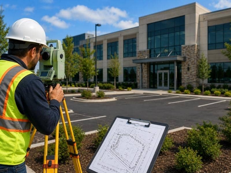
An ALTA land survey is an important part of many commercial real estate deals. It gives buyers, lenders, title companies, and property owners clear information about the land before the closing date.
When the process starts early and everyone shares the right documents, the survey can help the deal move forward with fewer problems. However, missing records, unclear survey requests, hard site conditions, and slow communication can delay the work.
These issues may lead to extra field visits, survey changes, or more review time. Knowing what causes delays can help property teams avoid last-minute problems and keep the closing on schedule.
Why Missing Property Records Delay an ALTA Land Survey
A surveyor needs complete property records before starting an ALTA land survey. These records help explain the legal history of the property and show what must appear on the final survey.
Important documents may include the current deed, title commitment, legal description, easement records, recorded plats, and older surveys. If one or more of these records are missing, the surveyor may not have enough information to complete the work.
Problems can also happen when documents do not agree. For example, the legal description in a deed may differ from the one in a title commitment. An easement may be listed in one record but missing from another.
When this happens, the surveyor must spend more time checking records and asking questions. The title company or attorney may also need to find added documents.
The best way to avoid this delay is to gather all property records before ordering the survey. Early document review gives the surveyor more time to find and solve problems.
Common Site Conditions That Create Unexpected Survey Delays
Even with complete records, the site itself may create delays.
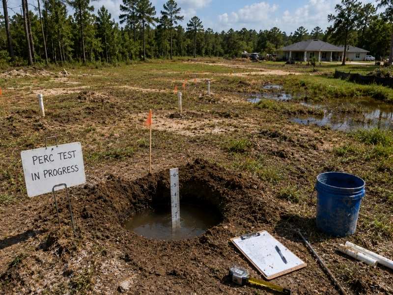
Surveyors need safe and clear access to the property. Locked gates, active work zones, heavy brush, standing water, or blocked areas can make fieldwork harder. Large commercial sites may also require more time because crews must measure many features.
Missing survey monuments can also slow the process. These markers help surveyors confirm property lines. If they are damaged, buried, or gone, the surveyor may need more fieldwork and record research.
Conflicting boundary evidence may also require added study. A fence, wall, driveway, or other feature may not match the recorded property information. The surveyor must review the evidence before reaching a final result.
Common site issues include:
- Heavy brush or trees that block access
- Locked or restricted areas
- Active construction or unsafe work zones
- Missing or damaged property markers
- Conflicting signs of property lines
Property owners should tell the surveyor about known site problems early. This helps the survey crew plan the right equipment, staff, and amount of time.
Table A Items That Are Often Overlooked Before Ordering
An ALTA land survey follows a set of standard requirements. It may also include optional items listed in Table A.
These items provide added details when a lender, buyer, attorney, or title company needs them. Some requests may require more research, fieldwork, or map details.
A common mistake is choosing Table A items after fieldwork has already started or ended. If the surveyor did not collect the needed information during the first visit, the crew may need to return to the site. That extra visit can raise the cost and slow the closing.
The project team should discuss Table A items before ordering the survey. The lender, title company, buyer, and attorney should confirm what information they need and send those choices to the surveyor.
Early planning helps the surveyor prepare the right scope of work and reduces the chance of late changes.
Why Early Coordination Between Surveyors and Title Companies Matters
Commercial closings involve many people. The buyer, seller, lender, title company, attorney, surveyor, and property manager may all need to review part of the deal.
Poor communication can cause delays when one person is waiting for information from another.
The title company may need to send record documents to the surveyor. The surveyor may find an issue that needs legal review. The lender may request added survey details. The property owner may need to provide access to part of the site. When these steps happen late, the closing date can be at risk.
Early coordination gives the team time to solve problems. It also helps everyone understand the survey deadline, review process, and final delivery date. A clear point of contact can make the process easier. That person can collect questions, share records, and make sure the right people receive updates.
Reviewing an ALTA Land Survey Before the Closing Date
The project team should review the completed survey as soon as it arrives. Waiting until the day before closing leaves little time to ask questions or request changes.
The review may include property lines, buildings, access points, easements, encroachments, parking areas, and title exceptions. Buyers and lenders may also compare the survey with the title commitment. An encroachment happens when a building, fence, pavement area, or other feature crosses a property line or easement. This may require more review before the deal can close.
The title company or attorney may also find a record that does not match the survey. The surveyor may need to explain the issue or revise part of the drawing. Early review gives the team time to handle these questions without rushing. It also helps prevent last-minute changes to loan or closing documents.
Frequently Asked Questions
What documents should be provided before an ALTA land survey begins?
The surveyor may need the current deed, title commitment, legal description, easement documents, recorded plats, and any older surveys. Complete records help the work move faster.
Can an ALTA land survey delay a commercial closing?
Yes. Missing records, hard site conditions, late Table A choices, or unresolved survey questions can delay the closing. Early planning can reduce these risks.
What are Table A items on an ALTA land survey?
Table A items are optional survey details that a client or lender may request. Some items need added research or fieldwork, so they should be chosen before the survey starts.
How long does an ALTA land survey usually take?
The timeline depends on the size of the property, the quality of the records, site access, and the amount of work required. Large or complex properties may take longer.
Who typically requests an ALTA land survey?
Buyers, lenders, title companies, attorneys, developers, and commercial property owners may request an ALTA land survey during a real estate deal.


 Land Surveyors are professionals who make precise measurements to determine the size and boundaries of a piece of real estate. While this is a simplistic definition, boundary surveying is one of the most common types of surveying related to home and land owners. If you fall into the following categories, please click on the appropriate link for more information on that subject: