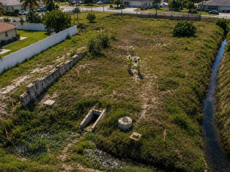
A loan closing survey can stop a deal cold, even after everything else looks approved. Developers assume that once the appraisal is done and the paperwork is signed, funding is a formality. It isn’t. Lenders use the survey as a final check, and what it finds can change the terms of the deal or stop it outright.
Here’s what a loan closing survey actually looks for, and why it matters more than most borrowers expect.
Why Lenders Look for Physical Conditions That Do Not Match the Title
A title report tells a lender what should be true about a property. A survey tells them what is actually true. Lenders want both to agree before they release funds, because a mismatch between the two creates risk they don’t want to hold.
A structure sitting outside the platted lot, a fence in the wrong spot, or a building that doesn’t match the legal description all count as red flags. None of these has to be intentional fraud. Sometimes it’s just old paperwork that never got corrected. But the lender still has to account for it before funding moves forward.
What to do:
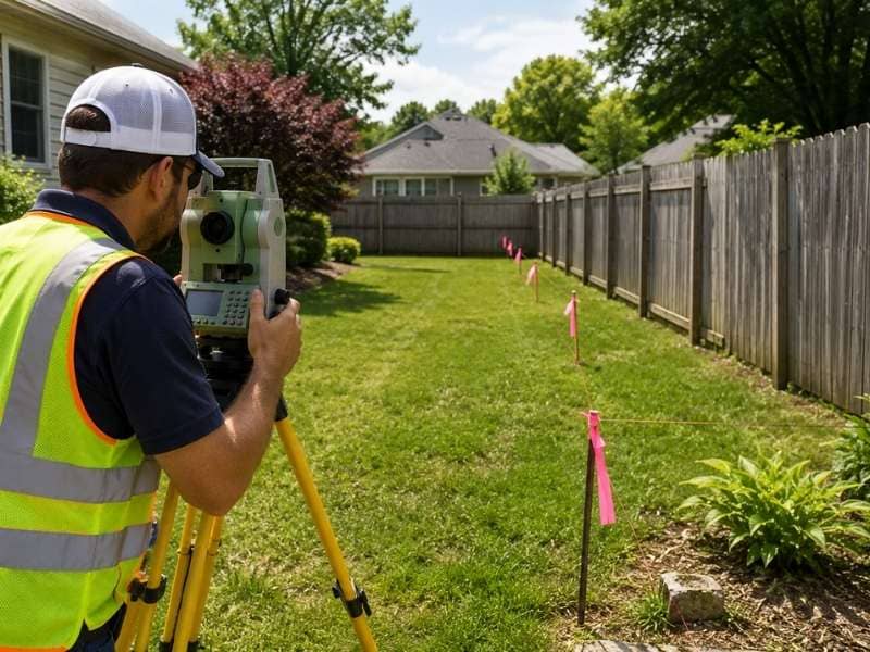
- Order the survey early enough to catch mismatches before your closing date.
- Ask the surveyor to flag any physical condition that conflicts with the recorded title description.
- Get any discrepancy explained in writing before the lender’s underwriting team reviews the file.
How Unmapped Access Issues Can Create Funding Delays
Lenders want to know a property has legal, usable access before they fund a loan. That sounds simple, but access problems are common on parcels that were split, sold in pieces, or developed before current road standards existed.
A closing survey checks whether the access shown on paper actually connects to a public road, and whether that access is wide enough and legally documented. If the only path in crosses a neighboring lot without a recorded easement, that’s a problem the lender has to resolve before releasing money.
What to do:
- Confirm your access route is both physically present and legally recorded before applying for the loan.
- Ask the surveyor to trace the access path from the property to the nearest public road.
- Get any missing access agreement recorded well before your target closing date.
Why Old Improvement Locations Can Trigger Last-Minute Review
Structures built years or decades ago don’t always sit where old records say they should. A garage might be a few feet closer to the property line than the original permit shows. An addition might extend past what was ever approved.
These older improvements can sit quietly for years without causing a problem, until a closing survey measures them against the current legal description. When the numbers don’t match, the lender’s underwriting team has to review it, and that review often happens right before closing, when there’s no time to spare.
What to do:
- Ask for a copy of the original permits for any older structure on the property.
- Have the surveyor compare improvement locations against both the current survey and any older plats on file.
- Address known discrepancies with the seller before signing, not after the survey comes back.
How Survey Exceptions Can Change the Lender’s Risk Decision
A survey exception is any issue the surveyor flags that needs resolution before the deal is considered clean. Lenders treat these differently depending on severity. A minor issue might just get noted in the loan file. A serious one can change the loan terms, require additional insurance, or stop funding altogether.
This is where communication between the surveyor, the title company, and the lender matters most. A borrower who doesn’t understand why an exception matters can end up surprised when it delays their closing date by weeks.
What to do:
- Ask your lender directly how they plan to handle any exception the survey turns up.
- Request the survey results early enough to negotiate exceptions with the seller before your rate lock expires.
- Keep a paper trail of how each exception was resolved, in case underwriting asks for it again later.
Why Closing Surveys Sometimes Reveal Problems After Appraisal Is Done
An appraisal values a property based on what it’s assumed to be. A closing survey confirms what it actually is. These two processes run somewhat independently, and that gap means a survey can turn up a boundary or access problem that the appraisal never considered.
This timing catches borrowers off guard more than anything else on this list. The appraisal comes back clean, the loan feels locked in, and then the survey finds something that sends the file back to underwriting. It’s frustrating, but it’s also exactly why the survey exists as a separate step.
What to do:
- Order the survey as close to the start of the loan process as possible, not after the appraisal.
- Ask your loan officer whether the survey and appraisal can be scheduled closer together to reduce the gap.
- Build a buffer into your closing timeline in case the survey requires a follow-up review.
What This Means for Your Next Closing
A loan closing survey checks facts the appraisal and title report don’t fully cover. Mismatched physical conditions, access gaps, old improvement discrepancies, survey exceptions, and late-stage findings after appraisal can all slow down or stop funding. Order the survey early, review every flag with your lender, and build room into your timeline. It’s a lot cheaper than a delayed or dead deal.
Frequently Asked Questions
Can a loan closing survey cause a lender to change loan terms after preapproval?
Yes. If the survey reveals a risk the lender did not account for during preapproval, the lender may adjust the loan amount, require additional coverage, or add conditions before funding.
How far in advance of closing should a loan closing survey be ordered?
Most lenders want it several weeks before closing, though this varies. Ordering it too close to the closing date leaves little time to resolve issues it finds.
Does every type of loan require a closing survey?
Requirements vary by lender and loan type. Commercial loans and construction loans often require one, while some residential loans may accept an older survey if nothing has changed.
What happens if the closing survey and the appraisal disagree on property details?
The lender’s underwriting team typically resolves the conflict. This may mean ordering a follow-up review or requesting clarification from both the surveyor and appraiser.
Can a borrower dispute a survey finding that a lender is treating as a major risk?
Yes, but it usually requires additional documentation or a second opinion from another licensed surveyor to support the dispute.