An ALTA Survey protects your commercial land investments near major new transit lines and growing neighborhoods. Buying land next to a busy transit corridor comes with real financial risk. Expanding roads and new utilities change property values and land use rules overnight. This detailed review gives you the exact facts you need to spot legal and physical problems before you close the deal.
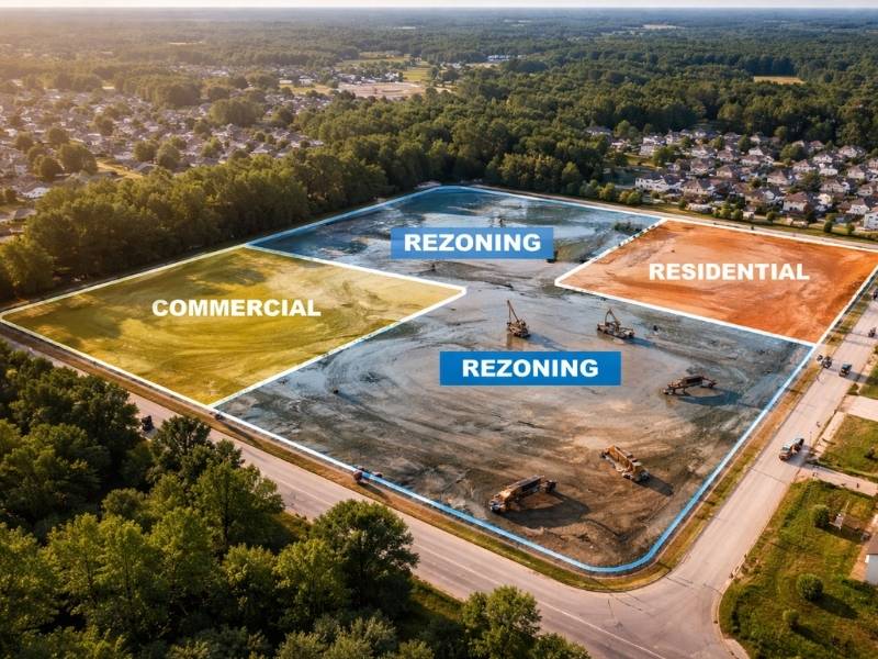
Rapid Residential Growth Can Change Property Conditions
Jacksonville is growing fast. New housing developments are popping up along major roads like Interstate 295 and State Road 9B. This rapid growth alters the land around it. A quiet parcel can quickly become a busy construction zone. Large tracts of forest and farmland are turning into suburban subdivisions. This shifts the physical environment around existing commercial properties.
New roads change how rainwater flows. Higher traffic counts might force the city to expand the right of way. If you buy commercial land in these areas, you must know how nearby projects affect your borders. Roads that were once narrow two lane streets often expand into four lane divided highways to handle commuter traffic. This infrastructure development can strip away valuable frontage from your site.
Data from an ALTA survey shows current physical features. It maps out new utility lines, recent grading, and changes to connecting roads. This prevents you from buying land that has lost its utility or access due to nearby city expansion. It gives developers a clear picture of what exists on the ground right now rather than what public records showed years ago.
Suburban expansions often bring major earthmoving projects. Neighboring parcels might see massive elevation changes as residential builders clear land and create building pads. These changes directly impact the natural slope of the area. A commercial plot that used to sit on high ground might suddenly face runoff issues due to higher adjacent grades. Staying ahead of these shifts requires real world physical data. Relying on outdated property maps during a regional construction boom can lead to unexpected liabilities after closing.
Recorded Easements and Access Rights Deserve a Closer Look
Expanding housing hubs require massive utility networks. Water lines, sewer lines, and electric grids must cross multiple parcels to reach new homes. These networks create easements. An easement gives someone else the legal right to use a portion of your land.
You cannot build a warehouse or a parking lot over a major water main easement. A standard boundary map might just list these items in a text document. This makes it difficult to see how the restriction cuts through your planned building footprint. An ALTA Survey plots every single easement directly on the property map. You see exactly where the restrictions sit. It also shows shared driveways and access rights. If a new housing neighborhood cuts off your direct path to a main road, the survey reveals that issue immediately.
Many commercial parcels rely on specific access agreements to stay functional. When large residential communities break ground, old access points frequently change. A shared driveway that once served two quiet commercial lots might now merge with a major subdivision entrance. This can disrupt the flow of delivery trucks or customer traffic to your site.
The survey map uncovers these hidden access bottlenecks. It explicitly outlines the legal boundaries of your access points. It shows if a newly recorded utility easement reduces the buildable area of your commercial lot. Knowing the exact path of underground pipelines and overhead lines allows your design team to layout structures accurately. This prevents expensive redesign fees during the permitting phase.
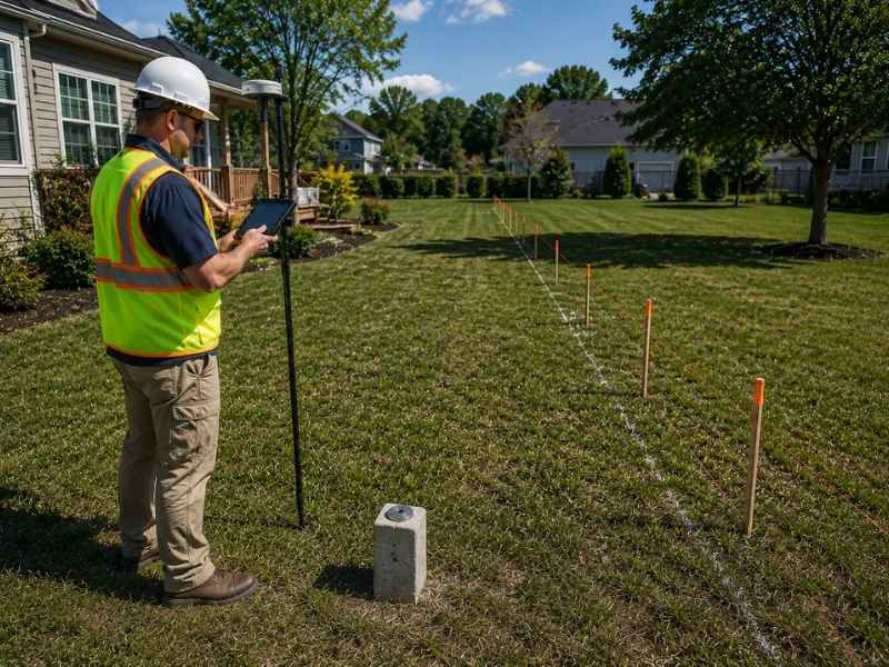
Boundary Issues Become More Important in Growing Areas
When developers rush to build homes, mistakes happen. Fences go up in the wrong spots. Retention ponds spill over onto adjacent lots. You cannot rely on old tax maps or vague descriptions. An ALTA Survey uses strict national standards to find and mark real property lines. It uncovers overlaps where two deeds claim the same strip of land. Finding these errors early allows you to demand a price drop or force the seller to clear the title before you sign the contract.
Boundary disputes can derail a development project before it even starts. If a neighboring residential builder sets a retaining wall over your line, it creates a cloud on the title. Title insurance companies will flag this issue and may refuse to provide clear coverage. This stalls your funding from commercial lenders.
An accurate survey resolves these questions by locating the physical pins buried in the ground. It proves exactly where your ownership ends and the neighbor’s begins. This is vital when dealing with rapid infill development where structures sit close together. Ensuring your site has undisputed boundaries protects your equity and keeps your project schedule on track.
Nearby Improvements May Create Hidden Risks
New construction next door creates physical risks for your investment. Builders clear trees and pave over dirt. This means rainwater has nowhere to go. It often flows straight onto nearby commercial parcels.
An ALTA Survey looks at more than just your property lines. It documents nearby improvements like drainage ditches, retaining walls, and utility poles. The map shows if a neighbor’s new stormwater system drains directly onto your site. It also flags overhead power lines that might limit your building height. Spotting these risks keeps you from inheriting expensive drainage issues or zoning violations caused by surrounding growth.
Off-site improvements can also create legal headaches. For example, a new sidewalk built by the city along your frontage might accidentally cross onto your lot. Or a neighboring subdivision might install a monument sign that encroaches on your land. These physical improvements are easily missed during a casual walkthrough.
The survey notes the exact location of all visible improvements within five feet of the property line. This detailed tracking protects you from future liability. If a neighbor’s structure sits on your land, you can address the violation before it becomes a permanent legal right through long term use.
Due Diligence Helps Buyers Make Better Decisions
Smart investors do not guess. They gather hard facts. Lenders and title insurance companies require an ALTA Survey for a simple reason: it removes blind spots.
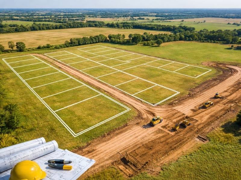
Commercial real estate transactions involving growth corridors require a deep look into the future. You are not just buying the land as it looks today. You are buying into an area that will experience intense development pressure over the next decade. An ALTA survey acts as your primary insurance policy against unforeseen site constraints. It ensures that your development plans remain viable as the surrounding neighborhood transforms.
Frequently Asked Questions
How does an ALTA survey differ from a standard boundary survey?
A boundary survey only locates property lines and corners. An ALTA survey follows strict national standards set by the American Land Title Association. It includes detailed information about easements, zoning, utilities, and nearby improvements that affect land use.
Why is an ALTA survey urgent when buying land near new Jacksonville housing corridors?
Fast regional growth brings rapid changes to local utilities, roads, and drainage systems. An ALTA survey ensures you see recent physical changes and newly recorded easements that standard public records might not show yet.
Can an ALTA survey help resolve a dispute over a neighbor’s fence?
Yes. The survey provides clear, legally recognized proof of your property lines. If a neighboring residential developer built a fence or a wall inside your property boundary, the survey documents this encroachment precisely.
What is Table A in an ALTA survey, and why should developers care?
Table A is a list of optional details you can add to your survey request. It includes items like parking space counts, building heights, specific utility locations, and wetland features. Developers use it to customize the survey for their specific building plans.
How long does it take to complete an ALTA survey?
It typically takes three to six weeks depending on the size of the land and the complexity of the records. Ordering the survey early in your due diligence period prevents unexpected delays before your closing date.