
↓
 

Jacksonville Land Surveying

Information related to Land Surveying Services in Jacksonville, Florida

Jacksonville Land Surveying
  • Home
  • ALTA Survey
  • Boundary Surveying
  • Construction Survey
  • Drone LiDAR Mapping
  • Elevation Certificate
  • Land Surveying
  • Topographic Survey
  • Blog
  • Contact Us
Home - Page 5 << 1 2 3 4 5 6 7 … 15 16 >>

Post navigation

← Older posts
Newer posts →

Why an Elevation Certificate Sometimes Becomes Urgent Right Before Closing

Jacksonville Land Surveying Posted on June 17, 2026 by JaxsurveyorJune 15, 2026
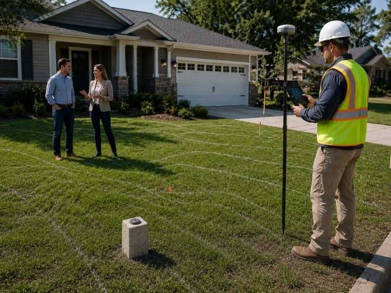
Why an elevation certificate sometimes becomes urgent right before closing is illustrated by a surveyor collecting elevation data while buyers discuss the property.

An elevation certificate is not something most people think about at the start of buying or selling a home. Buyers are focused on inspections and moving dates. Sellers are thinking about repairs and paperwork. But for homes near a flood zone, this one document can suddenly become the most urgent thing standing between a family and their closing day. And the request almost always comes later than it should.

Knowing why this happens can save a lot of stress.

Why Flood Insurance Questions Come Up So Late

Most home sales follow a pattern. An offer gets accepted. Inspections happen. The loan gets processed. Then the last details get wrapped up before closing. Flood insurance usually falls into that final stage. People treat it as a small detail rather than something to handle early.

That’s where the problem starts.

A lender looking over the final loan paperwork might flag the home’s flood zone for the first time. An insurance company asked to set up coverage might ask for elevation data before saying yes. A title company checking final requirements might find a flood-related item that nobody dealt with earlier.

None of this is strange. These are normal steps. The trouble is that they happen late, and the documents needed to answer these requests take time to get. When that need pops up just days before closing, everything depends on how fast the paperwork can be ready.

When Old Records Are Missing or No Longer Enough

Some homes already have an elevation certificate on file. A previous owner got it one year ago, and the document still exists. But an old certificate doesn’t always fix the problem.

A lender might want a certificate that matches the current flood map for that area. Flood maps get updated over time. If the maps have changed since the old certificate was made, the lender might not accept the older document.

An insurance company might also need measurements that match the home’s current flood zone rating, which can change when maps get redrawn.

Changes to the home itself can also make an older certificate wrong. If the home was raised, if a room below the main floor was added or changed, or if anything was done that affects how high the structure sits, the old certificate no longer shows accurate information.

Sometimes the certificate just can’t be found at all. The previous owner didn’t pass it on. It wasn’t included in the home’s records. Nobody can locate it. When that happens, the transaction has to start over on this point, even if a certificate was made years ago.

How Lenders and Insurance Companies Use This Information

Lenders and insurance companies both need elevation data, but for slightly different reasons.

For lenders, it comes down to risk. Federal law says that lenders must make sure flood insurance is in place for homes in high-risk flood zones before a government-backed mortgage can close. Elevation data helps confirm where the home stands and whether coverage is required. Without that answer, the loan cannot move forward.

For insurance companies, elevation information affects the cost of coverage. A home built well above the flood reference level for its area will usually cost less to insure. A home that sits near or below that level will cost more. If an insurer doesn’t have current elevation data, they can’t give an accurate quote or lock in coverage. That hold-up affects the whole timeline, not just the insurance part.

Both need this information before they can finish their job. When that need shows up close to the closing date, time runs out fast.

Why Last-Minute Problems Push Closing Dates Back

A closing date is not just a goal. It’s a set deadline that involves many people at once: the buyer, the seller, the lender, the title company, the real estate agents, and sometimes lawyers. When one document is missing, the closing doesn’t work around it.

Getting a new elevation certificate in the final days before closing means a licensed professional has to schedule a visit to the property, take measurements, and put the document together. That takes time. Depending on how busy the surveyor is and how complex the property is, that time may not fit in the current schedule.

If the certificate isn’t ready in time, the lender may not be able to give final approval. The insurance company may not be able to lock in coverage. The closing gets pushed back.

When that happens, sellers waiting to buy their next home may face their own problems. Buyers who already scheduled movers or arranged temporary housing have to make new plans. Contracts with firm closing dates may need to be changed, which requires everyone to agree.

One delay leads to another. The more people involved, the bigger the ripple.

How to Avoid Getting Caught at the Last Minute

The best way to avoid a last-minute elevation certificate problem is simple: ask about it early.

Sellers can check whether a certificate already exists before listing the home. If one is on file, it’s worth finding out whether it still matches the current flood map and the current state of the property. If it’s missing or out of date, dealing with that before the home goes on the market takes away a problem that could otherwise delay the sale.

Buyers should ask about flood zone status during the inspection and review period, not in the final days before closing. If the home is in or near a high-risk flood zone, finding out what documentation exists and what the lender and insurer will need gives enough time to get it handled without pressure.

Real estate agents and lawyers who work with flood zone properties tend to ask about elevation certificates early. They’ve seen what happens when the question gets left until the end. Making it an early step rather than a last-minute task keeps the whole process on track.

Frequently Asked Questions

What is an elevation certificate used for when buying or selling a home?

Lenders and insurance companies use it to understand the flood risk for a property. A lender may need it to confirm that flood insurance can be set up before approving a mortgage. An insurer uses it to decide whether coverage is required and what it will cost.

Why does the need for an elevation certificate come up so close to closing?

Flood-related steps often get reviewed late in the home sale process. A lender finishing up the loan or an insurer being asked to set up coverage may request elevation information that was never collected earlier in the transaction.

Can an old elevation certificate be used?

Sometimes. If the flood map for the area hasn’t changed and the home hasn’t been changed since the certificate was made, an older one may still work. If either of those things has changed, or if the lender or insurer has specific rules about how recent the certificate needs to be, a new one is usually required.

Who makes an elevation certificate?

A licensed land surveyor or another qualified professional with the proper authorization prepares the certificate. The finished document must be signed and certified by that professional.
Posted in elevation certificate | Tagged elevation certificate

How Long Does a Property Survey Stay Valid Before You Should Order a New One

Jacksonville Land Surveying Posted on June 15, 2026 by JaxsurveyorJune 15, 2026
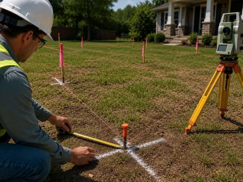
Land surveyor inspecting boundary markers and existing property lines to determine how long a property survey stays valid.

A property survey doesn’t come with an expiration date stamped on it. That surprises a lot of homeowners. Many assume a survey goes stale after a certain number of years, the way a driver’s license or a food label does. But that’s not how it works. Whether an existing property survey still holds up depends on what has changed on the land, what you plan to use the survey for, and who needs to rely on it.

Knowing the difference between a survey that’s still good and one that needs updating prevents delays and avoids expensive surprises.

Why Age Alone Does Not Determine Whether a Survey Is Still Reliable

A survey completed fifteen years ago might still be perfectly usable. One completed three years ago might already be out of date. The age of the document matters far less than the condition of the property and the boundary evidence currently on the ground.

A survey captures a specific moment in time. It shows where the boundaries were, what improvements existed, and where the physical markers sat when the surveyor finished the work. If nothing has changed since then, the information may still be accurate.

But “nothing has changed” covers more ground than most homeowners expect. It includes the physical condition of the property, the state of the boundary markers, any structures or improvements added since the survey date, and whether the legal description of the property has been changed through a deed revision or subdivision. If all of those things remain the same, an older survey can still serve its purpose.

Changes on the Property That Can Make an Older Survey Less Useful

Physical changes are the most common reason an existing survey stops being reliable. A survey only shows what was there when it was made. Anything added or changed after that date simply doesn’t appear on the document.

Common improvements that can affect whether an older survey is still useful include:

  • New structures. A garage, shed, or any detached building added after the survey date won’t appear on the existing document. If the location of that structure matters for a permit, a sale, or a dispute, the survey will be missing key information.
  • Fences and walls. A fence installed along what someone thought was the property line may or may not match where the boundary actually is. An older survey won’t show that fence or confirm whether it was placed correctly.
  • Driveways and paving. Paved surfaces built near a boundary line can raise questions about whether they cross onto a neighboring property. If a driveway was extended after the survey was done, that change won’t appear on the record.
  • Grading and landscaping near boundary lines. Retaining walls, raised planting beds, and significant grading near the edges of a property can alter how the land looks. These changes may not affect the legal boundary, but they often come up during real estate transactions and permit reviews.

None of these improvements move the boundary lines. But they do create gaps between what the survey shows and what currently exists on the ground, and that gap can create problems when others need to use the document.

Why Different Transactions May Have Different Survey Requirements

Not every use of a survey comes with the same standards. A homeowner pulling out an old survey to settle a question about a fence line has different needs than a lender processing a refinance or a title company issuing insurance for a sale.

Lenders often have their own rules about survey age. Some accept an existing survey if it meets certain conditions. Others require a new or updated survey that confirms the boundaries and improvements haven’t changed since the original was completed. These rules vary by lender, loan type, and sometimes by state.

Title companies face a similar situation. When issuing title insurance, a title company needs confidence that the survey reflects the current state of the property. An older survey that doesn’t account for recent improvements may not give them that confidence.

Buyers in a real estate transaction sometimes request an updated survey as part of their review process, even when an existing one is available. Seeing current conditions documented clearly gives them a more accurate picture of what they’re purchasing.

The safest approach is to confirm what each party actually requires before assuming an older survey will be accepted.

How Missing Boundary Markers Affect Older Surveys

Even when a property hasn’t changed physically, the markers used to establish its boundaries can deteriorate over time. Corner markers get buried under years of soil buildup and landscaping. They get knocked loose by equipment working on a neighboring lot. In some cases, they get removed by someone who didn’t know what they were.

When a licensed surveyor returns to a property to verify an older survey or perform a new one, part of the work involves finding the original monuments. If those markers are missing or disturbed, the surveyor has to reconstruct the boundary using other evidence, including deed records, neighboring surveys, and any remaining physical points that can be tied back to the original measurements.

This process takes more time when the evidence is incomplete. It can also affect how confident anyone can be in the results. A boundary established from strong, intact evidence is far more reliable than one pieced together from partial information.

If the corner markers on a property can’t be located, that alone is a good reason to have the situation assessed by a licensed surveyor.

Questions Worth Asking Before Reusing an Existing Survey

Before deciding whether an older survey is good enough for a current purpose, a few questions help clarify the answer:

  • Has anything been built, added, or changed on the property since the survey date?
  • Are the original corner markers still visible and in place?
  • Who will be relying on the survey, and do they have specific requirements about how recent it needs to be?
  • Has the legal description of the property changed through a deed revision, lot split, or boundary adjustment?
  • What will the survey actually be used for?

If the answers to any of these raise doubts, a licensed surveyor can review the existing document and give an honest assessment of whether it still reflects current conditions or whether updated fieldwork makes sense.

Frequently Asked Questions

How long can a property survey be used?

A property survey can remain useful for many years if the land hasn’t changed and the boundary markers are still intact. There is no universal expiration date. What matters is whether the document still accurately reflects the current condition of the property and whether the party relying on it will accept it.

Will a lender accept an older property survey?

Some lenders will, and some won’t. Requirements vary by lender, loan type, and state. The straightforward way to find out is to ask the lender directly before assuming an existing document will work for a current transaction.

Do home improvements affect whether an existing survey is still usable?

Yes. Any structure, fence, driveway, or significant grading change added after the survey date won’t appear on the existing document. If that information matters for the current purpose, an updated survey may be needed to show what’s actually on the property today.

What should I do if I can’t find the corner markers on my property?

Missing corner markers are a good reason to contact a licensed land surveyor. They can assess whether the original monuments still exist, whether they can be located using other evidence, and whether updated fieldwork is needed to establish or confirm the boundary.

Posted in boundary surveying | Tagged boundary survey

Why Boundary Survey Costs Can Vary From Property to Property

Jacksonville Land Surveying Posted on June 10, 2026 by JaxsurveyorJune 8, 2026
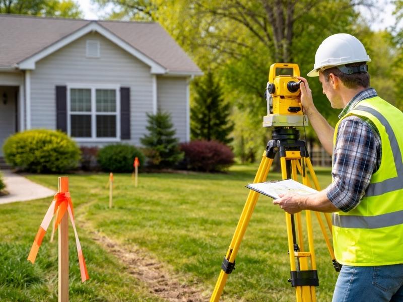
 Land surveyor in a safety vest and hard hat using surveying equipment to measure a residential property boundary in a suburban neighborhood.

When you look at two empty lots of the exact same size, you might expect their mapping fees to match. That assumption is a fast way to blow out your pre-construction budget. Developers quickly learn that why boundary survey costs can vary from property to property comes down to hidden land features and messy history rather than acreage alone.

A simple field map relies on hours of courthouse research and physical search labor. If the historical data is a mess, your price tag goes up.

The Condition of Historical Land Records

Every property line evaluation begins in a dark records room or a county database. A mapping specialist must pull old deeds, original subdivision plats and regional maps. Some areas have clean digital files that take minutes to find, while older commercial zones often rely on handwritten documents from the past century.

If those old papers contain vague descriptions, the job gets harder. A deed that references an old oak tree or a long-gone wooden post requires hours of comparison research. The specialist has to piece together the entire neighborhood puzzle just to find your start point. This deep research phase adds hours to the clock before anyone steps into the field.

Physical Obstacles and Site Access

Open fields are cheap to measure because light signals pass across the dirt without blockage. Real estate plots are rarely that empty or flat.

Physical obstacles slow down field crews. When workers have to fight through thick brush, the timeline stalls out.

  • Thick pine woods and heavy undergrowth that block sight lines
  • Steep slopes, deep ravines or active swamp areas
  • High security fences or locked commercial gates
  • Existing brick buildings that block modern satellite signals

Crews sometimes have to clear paths by hand to get clean measurements. If a site requires extra personnel or specialized gear, your price increases.

Why Boundary Survey Costs Can Vary

The physical shape of your plot dictates the layout math. A standard square parcel needs very few setups. A parcel with an odd geometric footprint forces the field crew to complete extra steps.

Counting the Total Property Corners

A square piece of land has four clear corners. A custom shaped lot can have a dozen or more turn points. Each corner requires individual location work and verification. More corners mean more time spent matching the field data to the legal text.

Replacing Missing Property Pins

Past crews usually buried iron rods at the original corners of a lot. Utility work and road grading often rip those markers right out of the dirt. If your pins are gone, the crew must hunt for pins on nearby properties. They use those distant points to recalculate where your corners belong.

The Presence of Encroachments and Shared Boundaries

When neighbors stay on their own side of the line, fieldwork moves fast. Disputes and structural overlaps complicate the equation.

If a nearby business built an asphalt driveway over your line, the field crew must document the exact area of that mistake. They have to measure the overlap with high precision to support future legal actions. Mapping these disputes requires double-checking every single measurement to withstand a challenge in court.

Required Accuracy Standards and Intended Site Use

A quick loan map for a local bank requires less precision than a high-rise construction layout. The final cost reflects the liability and precision your project demands.

If you plan to subdivide a block into tiny retail lots, local laws require tight accuracy tolerances. The mapping team must use slow, precise methods to meet those rules. High-stakes projects require more checks, which increases your overall pricing.

Choosing the Right Season for the Project

Weather and seasonal growth change the difficulty of field measurements. The time of year you order the fieldwork alters the speed of the crew.

Summer brings heavy leaf cover that blocks laser tools. It also brings high heat that slows down physical labor. Winter clearing makes ground markers easier to see from a distance, which cuts field hours. Planning your orders around seasonal changes can save you money on extensive site visits.

Frequently Asked Questions

Why does an urban lot cost more to map than a large rural field?

Urban areas have layers of old utility lines, shared brick walls and conflicting deeds. Finding clear reference points in a built-up city center takes more effort than shooting straight lines across an open farm.

Can I save money if I provide an old map?

Yes, sharing past paperwork gives the professional a great starting point. It can cut down the hours spent researching files at the county building. The crew must still verify those lines on the physical ground.

How do missing property markers change my overall price?

If your iron corners are gone, the team cannot just verify your lot. They have to measure from the nearest surviving neighborhood pin. This means they end up mapping parts of your neighbor’s land just to find your corners.

Does the value of the land alter the mapping fee?

High-value commercial zones carry more legal risk for the professional. If a small mistake occurs on a million-dollar downtown lot, the financial damage is huge. Insurance and liability costs push those service prices higher.

Why do irregular shapes increase project expenses?

Every extra turn or curve requires a separate machine setup and a new set of mathematical calculations. Complex shapes prevent the crew from using fast line-of-sight methods, which keeps them on your site longer.

Posted in land surveying | Tagged boundary survey

Post navigation

← Older posts
Newer posts →
Get Quote Button

Jacksonville Florida Land Surveyors

© Copyright Jacksonville Land Surveying
Jacksonville, FL
Phone: 904-712-2289

Privacy Policy | Terms of Use
Web Development and SEO by:
N2Biz.co
↑