When an Elevation Certificate Helps Lower Flood Insurance Costs
An elevation certificate shows how high a building sits compared to expected flood levels. It gives insurers, local officials, and owners facts about the building’s height and flood risk.
This document may help lower flood insurance costs. This happens when the measured height shows the building faces less risk than old records show. But lower rates are not guaranteed. Insurers also look at other things. These include flood frequency, distance from water, and the type of foundation.
An elevation certificate still gives useful facts. It may help an agent look closely at the property. The agent can then decide if the measurements support a lower price.
Why Flood Insurance Prices Depend on Accurate Elevation Data
Flood insurance prices depend partly on the chance that floodwater could enter or damage a building. One key fact is the height of the first floor. This is compared to the expected flood level.
A building with a higher first floor may face less risk. Floodwater must rise farther before it reaches the living space. FEMA’s National Flood Insurance Program uses First Floor Height as one factor when setting prices. Owners may send in an elevation certificate to see if it could lower their cost.
The certificate does not set the price by itself. Pricing may also depend on the building’s location, nearby water, flood frequency, foundation, and cost to rebuild.
So owners should not assume that a certificate will always save money. The document gives better facts. The insurance company then uses those facts as part of its full risk review.
Properties That Benefit Most From an Elevation Certificate
Most owners do not need an elevation certificate just to buy flood insurance. Still, some homes may benefit more than others. FEMA says owners in high-risk flood zones may need one. This shows the property follows local flood safety rules.
An elevation certificate may also help when records do not show the building’s true height. Older homes often have missing or old data. In these cases, an insurer may guess the height until the owner sends in real measurements.
Properties near the edge of flood-zone maps may also benefit. The map may place the land in a certain zone. But the certificate can show the exact height and spot of the building itself.
Common cases include:
- An older home with no elevation record
- A building near the edge of a flood zone on the map
- A property with a price based on a guessed height
- A home that was raised or changed after old records were made
- A buyer who wants clear flood-risk facts before buying
Owners should first ask their local floodplain manager if a certificate is already on file. This person may work for the city or county building office.
What Information Is Included on an Elevation Certificate
An elevation certificate has more than one height measurement. It gives a full record of the building, the property, and the flood facts used during the survey. The form may list the address, legal details, flood zone, map facts, building type, and the lowest floor height. It may also show the height of garages, crawlspaces, basements, equipment, and nearby ground.
The surveyor records heights using a known point, called a benchmark. This lets other experts see how the measurements relate to the official flood map. The certificate may compare the lowest floor to the Base Flood Elevation. FEMA says the Base Flood Elevation is the expected height of water during a flood. This type of flood has a 1 percent chance of happening in any year.
The form also has photos and certification details. These help show the building type and back up the measurements.
How Surveyors Collect Elevation Information for Certification
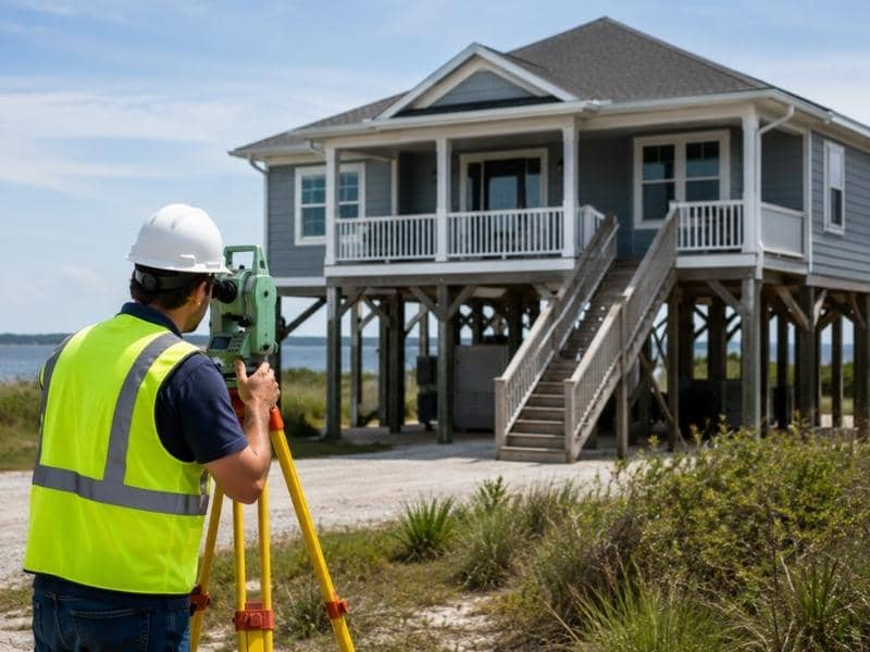
A trained surveyor starts by checking flood maps, property facts, and elevation points. FEMA’s Flood Map Service Center gives access to official flood maps. During the visit, the surveyor measures the building and nearby ground. Tools may include a digital level, total station, or GPS survey gear. The surveyor ties these measurements to an approved benchmark.
The surveyor may measure the lowest floor, the lowest ground next to the building, the highest nearby ground, garages, and key equipment. The exact measurements depend on the building type. Being precise matters. Small height differences can change how flood risk is understood. A mistake could lead to a wrong insurance review or problems with local rules.
The FEMA form must usually be done by a land surveyor, engineer, or architect. This person must be allowed under state law to certify elevation facts. Some parts may also be done by a local official.
When to Update an Elevation Certificate After Property Changes
An old elevation certificate may still work if the building has not changed. But a new certificate may be needed after big work is done. It may also be needed when new flood data comes out. A home addition can change the building’s shape or lowest floor. Rebuilding after damage may also affect the records. Raising the building, changing the foundation, closing in a lower area, or moving key equipment can create new facts that need to be written down.
A new certificate may also help after a flood map is updated. Flood maps change from time to time as risks and local facts change. Before paying for a new survey, owners should show the old certificate to their agent, floodplain manager, or surveyor. These experts can help decide if the old form still gives enough facts.
Frequently Asked Questions
How does an elevation certificate affect flood insurance?
It gives the insurance company real facts about the building’s height and features. This may support a lower price, but it does not guarantee one.
Is an elevation certificate required for every property?
No. Most owners do not need one to buy National Flood Insurance Program coverage. Some properties in high-risk areas may need one for local rules.
Who is qualified to prepare an elevation certificate?
A land surveyor, engineer, or architect allowed by state law may complete and certify the facts. Local officials may complete some parts when allowed.
Can an old elevation certificate still be used?
Maybe. It may still work if the building has not changed. It also must have the facts the insurer or local official needs.
Does an elevation certificate change my FEMA flood zone?
No. The certificate records the building’s spot and height. It does not change the official flood map by itself. FEMA must approve a formal map change for that to happen.
