↓
 

Jacksonville Land Surveying

Information related to Land Surveying Services in Jacksonville, Florida

Jacksonville Land Surveying
  • Home
  • ALTA Survey
  • Boundary Surveying
  • Construction Survey
  • Drone LiDAR Mapping
  • Elevation Certificate
  • Land Surveying
  • Topographic Survey
  • Blog
  • Contact Us
Home - Page 8 << 1 2 … 6 7 8 9 10 … 15 16 >>

Post navigation

← Older posts
Newer posts →

Why Is My Boundary Survey Quote So High?

Jacksonville Land Surveying Posted on May 20, 2026 by JaxsurveyorMay 13, 2026
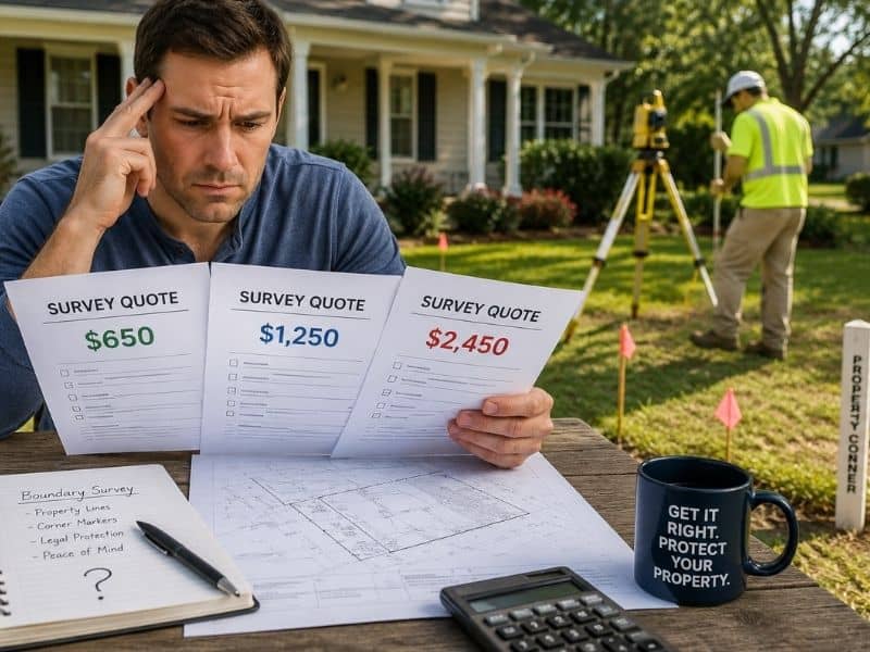
Homeowner comparing different boundary survey quotes while a land surveyor works near property markers outside a suburban home

You called around, asked for quotes, and now you’re staring at numbers that make no sense. One surveyor gave you a price that seemed fair. Another was almost double. A third was so high you figured they just didn’t want the job.

You’re not alone. This is one of the biggest frustrations for homeowners shopping for a boundary survey. And almost nobody explains why it happens.

This article will.

Why Is There Such a Big Price Difference?

The simple answer is that no two boundary surveys are the same.

It’s not like painting a room, where the price mostly depends on square footage. A boundary survey is a legal process. The cost depends on things that aren’t obvious until a surveyor looks closely at your specific property.

Two houses on the same street can require very different amounts of work. That’s why quotes can look so different, even for the same address.

What Actually Drives the Cost

1. The Size and Shape of Your Lot

Bigger lots take more time to measure. Odd shapes with lots of corners and angles add even more work. A simple square lot is a very different job from a large, uneven piece of land with many boundary lines.

2. Your Property’s History

This one surprises most homeowners, but it’s often the biggest factor.

Before visiting your property, a surveyor spends hours going through public records. They check your deed, old surveys, and documents going back many years. If everything is clear and well-recorded, that research goes quickly.

But if your property has changed hands many times, has unclear descriptions, or has old surveys that don’t match, the research alone can take a long time. Jacksonville has many older neighborhoods with exactly this kind of complicated history.

3. Whether Corner Markers Exist

Corner markers, also called monuments, are small pins or rods in the ground at the corners of your property. Over time, they get disturbed by construction, covered by dirt, or simply lost.

When a surveyor finds markers in good shape, the job moves fast. When they can’t find them, new ones have to be placed. That takes more time and raises the cost.

4. What You Need the Survey For

A survey for a backyard fence is a simpler job than one needed for a court case. Legal disputes require more paperwork, more detailed records, and sometimes the surveyor has to testify in court. All of that adds to the cost.

If you tell a surveyor your survey is for a lawsuit, expect a higher quote. That’s not unfair. It’s an honest reflection of the extra work involved.

5. How Busy the Surveyor Is

Jacksonville’s housing market has been very active. Good surveyors are in high demand. Some charge more during busy periods just to manage their workload. That’s another reason quotes can vary even when the job looks the same.

What “I Don’t Want This Job” Pricing Means

Here’s something most people don’t know. Sometimes a high quote just means the surveyor doesn’t want to take the job.

Maybe they’re already overbooked. Maybe they looked at your address and saw a complicated history they’d rather skip right now. So they quote high as a polite way of saying no.

That’s not always a bad thing. A surveyor who is upfront about not wanting your job is better than one who takes it and does it poorly.

The best way to figure this out is to ask questions. A good surveyor should be able to explain what’s driving their price. If they can point to specific reasons, the quote makes sense. If they can’t explain it, it might just be a pass.

How to Pick the Right Surveyor

Price is just one thing to look at. Here’s what else matters:

Check their license. In Florida, only a licensed Professional Land Surveyor and Mapper (PLSM) can legally do a boundary survey. Ask for their license number and check it through the Florida Department of Agriculture and Consumer Services website.

Look for local experience. A surveyor who works often in Jacksonville and Duval County knows the local records and common issues in the area. That local knowledge saves time and leads to better results.

Understand what’s included. Some quotes cover fieldwork and a basic map. Others include setting new corner markers or preparing legal descriptions. Know what you’re getting before comparing prices.

Notice how they communicate. Did they respond quickly? Did they ask about your property before quoting? A surveyor who asks good questions upfront is more likely to do the job right.

Red Flags in a Low Quote

A cheap quote isn’t always a good deal. Watch for these warning signs:

They won’t share their license number. Any real surveyor will give you this without hesitation.

No mention of records research. A proper boundary survey includes both fieldwork and a review of public records. If one is missing, it may not be a true boundary survey.

A very fast turnaround promise. Most residential surveys take one to three weeks. A next-day promise should raise questions about how thorough the work will actually be.

A vague scope of work. You should know exactly what you’re getting. If they can’t tell you clearly, that’s a problem.

Nothing in writing. Always get the price and scope of work in writing before anything starts.

Which Quote Should You Trust?

The big difference in boundary survey quotes isn’t random. It comes down to the real differences between properties, how much research is needed, and how busy a surveyor is.

The goal isn’t to find the cheapest or most expensive option. It’s to find a surveyor who explains their price clearly, has a valid license, knows the area, and communicates well from the start.

A boundary survey is a legal document that can protect your property rights for decades. Take a little extra time to choose the right person for the job.

Frequently Asked Questions

Why are boundary survey quotes so different from each other?

Every property is different. Lot size, history, missing markers, and the purpose of the survey all affect how much work is involved. Two surveyors can also price the same job differently based on their workload and business model.

Is the cheapest quote always a bad idea? 

Not always, but a low quote deserves a closer look. Make sure it covers both fieldwork and records research, includes marker placement if needed, and comes from a licensed PLSM.

What is a litigation survey and why does it cost more? 

It’s a boundary survey made for a legal dispute. It needs more detailed records, and the surveyor may need to testify in court. That extra work raises the cost.

How do I check a surveyor’s license in Florida? 

Use the Florida Department of Agriculture and Consumer Services online license lookup tool. Always check before hiring.

Does a higher price mean better accuracy? 

Not automatically. A well-reviewed local surveyor with solid experience can do a better job than a pricier firm with less knowledge of the area.

Can the price go up after the survey starts? 

It can, if unexpected problems come up like missing markers or conflicting records. A good surveyor will warn you about possible issues before starting and talk to you before adding to the cost.
Posted in boundary surveying | Tagged boundary survey

Why Surveyors Rely on LiDAR Mapping Today 

Jacksonville Land Surveying Posted on May 18, 2026 by JaxsurveyorMay 13, 2026
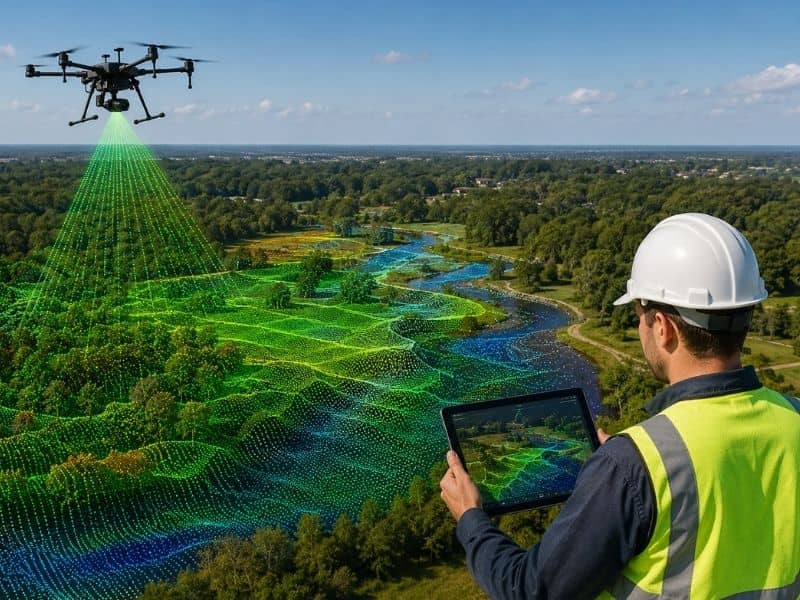
Survey drone using LiDAR mapping technology to scan wooded land and wetlands for elevation and flood analysis

LiDAR mapping is a surveying technology that uses laser pulses to measure the exact shape and elevation of land. It creates a detailed 3D picture of the ground that is far more accurate than traditional survey methods. For homeowners, buyers, and builders, understanding LiDAR can help you make smarter decisions about your property before you spend a single dollar.

What Is LiDAR?

LiDAR stands for Light Detection and Ranging. The idea behind it is simple.

Imagine pointing a flashlight at a wall and timing how long it takes for the light to bounce back to you. If you knew the exact speed of light, you could figure out the distance to that wall down to the inch. Now imagine doing that millions of times per second from a drone or airplane flying over your property.

That is exactly what LiDAR does.

A LiDAR sensor shoots out tiny laser pulses and records how long each one takes to return. The result is a massive collection of data points called a point cloud. When those points are mapped together, they create an incredibly detailed 3D image of the land below. Think of it as a digital X-ray of the earth’s surface.

How Is LiDAR Different From Regular Aerial Photography?

A regular photo from a drone shows you what land looks like from above. But it cannot tell you exact elevations, distances, or what is hiding under tree cover.

LiDAR can.

Because laser pulses pass through small gaps in tree branches, LiDAR can see the ground even underneath a thick forest. This is especially useful in Jacksonville, where wetlands, dense tree cover, and heavy vegetation make traditional aerial photos unreliable.

A standard photo might show you a flat green lawn. A LiDAR scan of that same lawn could reveal a hidden drainage ditch, a slope you cannot see with your eyes, or a low-lying area that floods during heavy rain.

How Does a LiDAR Survey Work?

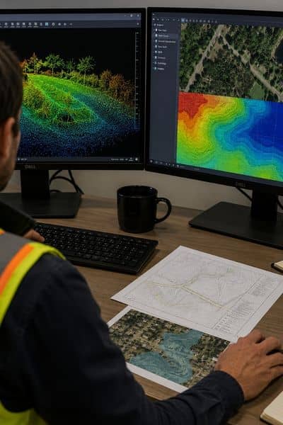
Surveyor reviewing LiDAR point cloud data and elevation maps at a workstation during land survey analysis

Here is a simple breakdown of what happens during a LiDAR survey.

Step 1. Data Collection A plane or drone with a LiDAR sensor flies over the area. The sensor fires millions of laser pulses toward the ground and records the data in real time.

Step 2. Point Cloud Processing All the data points are downloaded and processed using specialized software. The result looks like a dense map made of millions of tiny dots, each one showing an exact location on the earth’s surface.

Step 3. Ground Filtering The software separates ground points from everything else like trees, buildings, and power lines. What remains is called a bare earth model. This shows the true shape of the land with nothing on top of it.

Step 4. Final Deliverables From the bare earth model, surveyors can produce topographic maps, elevation profiles, and flood models. This data is then used to make important decisions about your property.

Why Does LiDAR Matter for Homeowners?

Jacksonville is flat. Much of the city sits just a few feet above sea level. With the St. Johns River, countless creeks, and frequent heavy rainfall, elevation matters more here than in most Florida cities.

Even a difference of one foot in elevation can determine whether your property falls inside a FEMA flood zone. That one foot can mean the difference between paying $500 a year in flood insurance and paying $3,000 or more.

Old survey methods used measuring tapes and manual calculations. They were accurate enough for their time but could not capture the full picture of a large piece of land quickly or at a low cost.

LiDAR changes that. It can map hundreds of acres in a single afternoon with accuracy down to a few centimeters. That level of detail gives you a much clearer picture of what you are buying or building on.

Real Situations Where LiDAR Helps Property Owners

Buying a home near a flood zone. LiDAR data shows the exact elevation of your property. If FEMA’s flood maps were made using older, less accurate data, a licensed surveyor can use LiDAR measurements to challenge your flood zone designation and potentially lower your insurance costs.

Planning to build a home or addition. Before construction begins, builders need to know how water moves across the land. LiDAR drainage maps show exactly where water flows during heavy rain, preventing costly mistakes like building in a spot that floods every summer.

Buying rural land. Walking every inch of raw land in North Florida is slow and sometimes dangerous. LiDAR surveys let surveyors map large tracts quickly and accurately, even through thick brush that is hard to reach on foot.

Resolving a property dispute. When neighbors disagree about where a property line falls, precise data from a LiDAR-assisted survey can provide clear and defensible evidence.

Does LiDAR Replace a Traditional Land Survey?

No, and this is important to understand.

LiDAR is a powerful tool that licensed surveyors use. It does not replace the surveyor. In Florida, only a licensed Professional Surveyor and Mapper can legally certify boundary lines, sign off on elevation certificates, or provide survey data that holds up in court or before a government agency.

Think of LiDAR like a stethoscope. It is a great tool, but it only means something in the hands of a trained professional. When you hire a surveying company that uses LiDAR, you get cutting-edge technology and a licensed expert who knows how to certify what the data shows.

Frequently Asked Questions

What is LiDAR mapping used for in land surveying? 

LiDAR mapping measures land elevation, creates topographic maps, identifies flood risks, and supports boundary surveys. In Jacksonville, even small elevation differences can affect your flood zone status and insurance costs.

Is LiDAR more accurate than a traditional survey? 

For large-area elevation mapping, LiDAR is faster and more detailed than traditional methods. That said, a licensed surveyor must still review and certify the data for it to be legally valid.

How does LiDAR affect my flood insurance? 

A LiDAR-based survey can show that your property sits higher than FEMA’s maps recorded. That difference in elevation can lead to a flood zone reclassification and a much lower insurance premium.

How long does a LiDAR survey take? 

Data collection for most residential properties takes just a few hours. Final maps and reports are typically delivered within a few days to a week.

Posted in land surveying | Tagged lidar mapping

How to Read a Topographic Survey

Jacksonville Land Surveying Posted on May 15, 2026 by JaxsurveyorMay 12, 2026
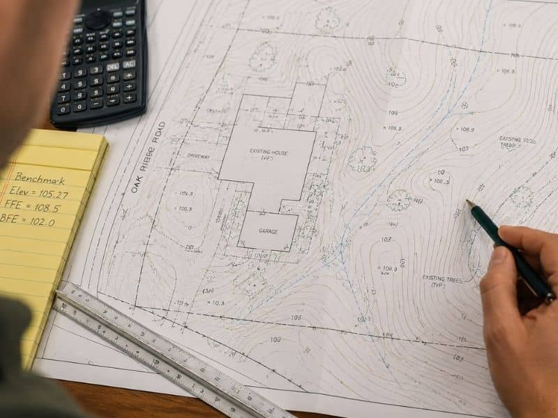
Homeowner reviewing a printed topographic survey with contour lines and elevation markings on a desk

You paid for a topographic survey. The PDF lands in your inbox. You open it and suddenly you are staring at something that looks like a weather map mixed with a maze.

Your contractor says everything looks fine. Your engineer starts talking about grades, contours, and elevations. Meanwhile, you are wondering what any of it actually means.

That happens to many property owners. However, learning how to read a topographic survey can save you thousands of dollars in drainage problems, permit delays, and flood-related repairs later.

Jacksonville is one of the flattest major cities in Florida. Because of that, even small elevation changes can affect how water drains across your property. A few inches can decide whether your yard drains properly or floods during heavy rain.

The good news is that reading a topographic survey becomes much easier once you understand what the lines, numbers, and symbols mean.

What a Topographic Survey Shows

A topographic survey shows the elevation, slopes, drainage patterns, and physical features of a property. In Jacksonville, even small elevation changes can affect flood risk, drainage performance, and permit approval. Reading a topographic survey correctly helps property owners understand how water moves across their land before construction begins.

A topographic survey, often called a topo survey, shows the shape of the land.

It maps:

  • slopes
  • low spots
  • hills
  • drainage paths
  • structures
  • utilities
  • natural features

The survey turns real land into a flat drawing that engineers, contractors, and property owners can read.

Every line and number on the survey represents something real on your property.

Topographic surveys matter because much of the area sits only a few feet above sea level. According to FEMA flood maps, many parts of Duval County fall within flood-prone areas near rivers, creeks, and wetlands.

That means your topo survey is not just showing land elevation. It is also showing how water may move during heavy rain.

How to Read Contour Lines on a Topographic Survey

Contour lines connect points of equal elevation across a property. Lines spaced closely together show steeper slopes, while lines farther apart indicate flatter ground. In Jacksonville, contour lines help identify drainage flow, low spots, and grading issues that may affect permits, flood risk, or future construction projects.

The curved lines covering most of your topo survey are called contour lines.

Each contour line connects points that sit at the same elevation.

These lines help show how the ground rises and falls across your property.

You will usually see two types of contour lines:

  • Index contours — thicker lines with elevation numbers
  • Intermediate contours — thinner lines between the labeled contours

The space between the lines is called the contour interval. In Jacksonville, surveyors often use a 0.5-foot or 1-foot interval because the land is so flat.

Quick Guide to Reading Contour Lines

  • Lines close together = steeper slope
  • Lines far apart = flatter land
  • V-shaped contours = drainage channel
  • Closed loops = raised or low ground
  • Lower elevation numbers = lower land elevation

Large areas of Jacksonville have very small elevation changes. Because of that, contour lines are important for spotting drainage problems before construction starts.

If the contour lines show water flowing toward your house instead of away from it, your engineer may need to adjust the grading plan.

Understanding Elevation Numbers on a Topo Survey

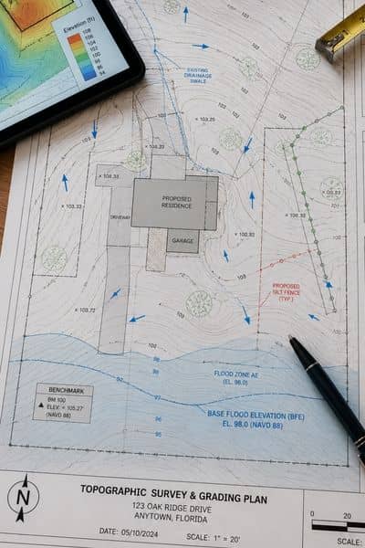
Printed topographic survey and grading plan showing contour lines, drainage arrows, and flood elevation notes on a desk

Elevation numbers on a topographic survey show the height of the land above mean sea level. Surveyors typically use NAVD 88 elevation standards. These numbers help determine flood insurance requirements, finished floor elevations, drainage compliance, and whether a property sits above or below FEMA flood zone levels.

Every elevation number on your survey shows the height of the land above sea level.

Most surveyors use a standard called NAVD 88. You do not need to remember the name, but it helps keep elevation measurements accurate and consistent.

One of the most important elevation numbers on your property is the Base Flood Elevation, also called the BFE.

FEMA assigns BFEs throughout Duval County to show how high floodwater could rise during a major storm.

Why Base Flood Elevation Matters

  • Homes below BFE often pay higher flood insurance costs
  • Homes above BFE may qualify for lower insurance rates
  • Elevation affects permit approval
  • Finished floor height matters during construction planning

In Jacksonville, some neighborhoods sit only inches above or below their assigned BFE.

That small difference can affect insurance costs and flood risk.

How Drainage Arrows Predict Water Flow Problems

Drainage arrows on a topographic survey show the direction stormwater flows across a property during rainfall. In Jacksonville, understanding drainage direction is important because new driveways, pools, and additions can redirect water toward homes, neighboring lots, or low areas that flood easily.

Some topo surveys include small arrows showing how water moves across the property during rain.

These drainage arrows are important before starting construction.

Adding a driveway, pool, patio, or room addition changes how water flows across your lot. If the project redirects water toward your home or your neighbor’s property, it can create serious drainage problems.

Jacksonville receives heavy rain during hurricane season and strong summer storms. Because of that, drainage planning is a major part of many construction projects.

The St. Johns River Water Management District reviews drainage impacts for many developments in Northeast Florida. Missing drainage information can slow down permit approval.

Before construction starts, check:

  • where water currently flows
  • where low spots exist
  • whether runoff moves toward structures
  • whether nearby construction could affect drainage

Your topo survey creates a record of existing drainage conditions before changes happen.

Common Symbols Found on a Topographic Survey

Topographic surveys use symbols to identify spot elevations, utilities, easements, wetlands, protected trees, and benchmark locations. These symbols help engineers, contractors, and property owners understand site restrictions, environmental concerns, and construction limits before starting a project.

Topo surveys include more than contour lines and elevation numbers.

They also contain symbols that show important property features.

Spot Elevations

X marks with numbers are called spot elevations.

These points show the exact elevation at one specific location.

Engineers use them when making detailed grading decisions.

Easements and Underground Utilities

Dashed lines often represent:

  • utility easements
  • underground pipes
  • drainage areas
  • access easements

These areas may limit where you can build.

Building over utilities or easements can create expensive problems later.

Wetland Boundaries

Hatched or shaded areas often mark wetlands or environmental buffers.

Jacksonville contains many wetland areas throughout Duval County. Building near wetlands may require special permits and setbacks.

Tree Symbols

Tree symbols often include trunk diameter numbers.

Jacksonville protects certain trees under local rules. Protected trees can affect where you place:

  • pools
  • fences
  • patios
  • additions
  • driveways

Benchmark (BM) Notation

BM stands for benchmark.

This is the fixed reference point surveyors use to calculate elevations across the property.

When Property Owners Need a Topographic Survey

Property owners often need topographic surveys before building pools, additions, drainage systems, or new structures. Topographic data is commonly required for grading permits, floodplain reviews, stormwater planning, and environmental permits throughout Duval County.

Many people do not think about topo surveys until permits become part of the project.

However, topo surveys are often required earlier than expected.

Building a Pool

Pool permits often require drainage review.

Your topo survey helps show how water will move after construction.

Adding an Addition or ADU

Home additions and accessory dwelling units often trigger grading and drainage reviews.

Elevation differences around the structure affect permit approval.

Buying Raw Land

Vacant land may look buildable from the road.

However, a topo survey may reveal:

  • flood-prone areas
  • drainage channels
  • wetlands
  • grading issues
  • utility restrictions

These issues can increase development costs.

Environmental Resource Permits

Incomplete topographic information is one of the most common reasons permit reviews get delayed.

Accurate topo data helps reduce problems during the approval process.

Common Mistakes Homeowners Make When Reading a Topographic Survey

Many homeowners misunderstand contour intervals, confuse boundary surveys with topographic surveys, or ignore FEMA flood elevation comparisons. These mistakes can lead to drainage problems, permit delays, redesign costs, and higher flood insurance expenses.

Even homeowners who study their surveys carefully can still miss important details.

Here are some common mistakes.

Confusing Boundary Surveys With Topographic Surveys

A boundary survey shows property lines.

A topographic survey shows the shape and elevation of the land.

Many projects need both surveys.

Ignoring the Contour Interval

Always check the contour interval listed on the survey.

A 2-foot interval on flat land may miss drainage issues that a 0.5-foot interval would show clearly.

Assuming Only Engineers Need the Survey

Your contractor and engineer will use the topo survey often.

However, property owners should understand it too because they are the ones living with the final results.

Not Comparing Elevation Data With FEMA Flood Maps

Your topo survey shows elevation numbers.

FEMA maps show flood zones and Base Flood Elevation data.

Comparing the two helps you understand flood risk more clearly.

Your Topographic Survey Is Telling You Something Pay Attention

Many property owners treat a topographic survey like complicated paperwork.

In reality, it contains valuable information that affects drainage, flood risk, construction costs, permitting, and long-term property protection.

The contour lines show how your land rises and falls.

The elevation numbers show how your property compares to flood levels.

The drainage arrows show where stormwater flows during heavy rain.

And the symbols identify site conditions that could affect your project later.

In a flat and flood-prone city like Jacksonville, understanding your topo survey is one of the best ways to avoid expensive problems before construction begins.

Posted in land surveying | Tagged Land Surveying

Post navigation

← Older posts
Newer posts →
Get Quote Button

Jacksonville Florida Land Surveyors

© Copyright Jacksonville Land Surveying
Jacksonville, FL
Phone: 904-712-2289

Privacy Policy | Terms of Use
Web Development and SEO by:
N2Biz.co
↑